

Volcanic Monitoring
Volcano Learning Zone > Volcanic Hazards>Volcanic Monitoring
Monitoring of volcanoes gives geologists data which can help when help in the prediction of eruptions. Earthquakes,gas emmisions and ground deformation studies all contribute data which shows whether the volcano is getting ready for an eruption.
 Seismic Activity
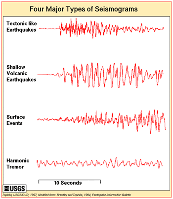
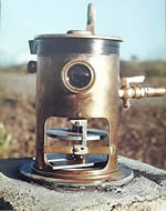
Magamtic earthquakes are caused by the mvement of magma within the volcano. They are often shallow, less than 10km,and although only RS 2-3 ,can damage property and set off landslides and rockfalls. They also indicate that the volcano is active and may be preparing for and eruption. Networks of seismometers and tiltmetres can pick up earthquakes and changes in the surface,
Long period events have been used to successfully predict volcanic eruptions Mount Redoubt,Alaska;Galeras,Colombia and Popocatapetl,Mexico, where thousands of people were safely evacuated from the largest eruption for a thousand years.Bernard Chouet a Swiss Geologist has pioneered the use of long period events and harmic tremors to successfully predict volcanic eruptions.
Gas Emmissions
 Gas emmisions,particularly of sulphur dioxide,will increase as a volcano moves closer to erupting. Sulphur emmisions ncreased 10x before Pinatubo erupted in 1991. However just before the volcanoes erupt it has been observed that emmissions drop as gas escape pathways are blocked by hardened magma. This increases pressure within the system and makes the eruption maore explosive. Taking ground measurements is dangerous so geologists also use aerial sensors such as COSPEC (Correlation spectrometer) for measuring sulphur dioxide.Li-COR measures CO2 emmissions.
Ground deformation
 Rising magma can cause the ground above to swell or inflate. Geologists measure the rise and fall with tiltmetres,lasers,GPS and satellite radar.
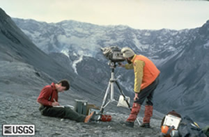
A network of seismometers is placed around the volcano and readings relayed to a computer where the earthquake patterns can be analysed.A network of tiltmetres can pick up changes in inflation and deflation of the volcanoes surface.
Temperature changes
Infrared sensors both airbourne and hand held can be used to map the heat being given off by the volcano. The Infra-red sensors on satellites can also pick out volcano hotspots although resolution is limited by the sensor and will not be as detailed as plane data.
 Drainage and hydrology
Changes in the level of water in boreholes can be used to redict eruptions. Ananysis of river sediments and changes in river erosion rates can also help.
Satellite Remote Sensing
Satellites can be used to monitor volcanoes. Eruption clouds can be mapped and seperatd from normal clouds. Sulphur dioxide can be picked up using TOMS (Total Ozone Mapping Spectrometer) which is used normally for mapping Ozone. Thermal and deformation sensing can also be carried out from space.
Geomorpholgy
Historic paths of landslides,lahars,rockfalls and pyroclastic flows can be mapped to show likely routes in the future.